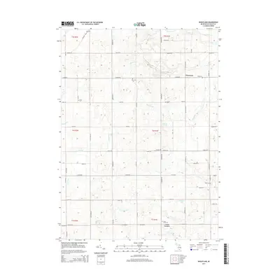
2014 Map of Wheatland
USGS Topo · Published 2014About this map
Wheatland and the surrounding township terrain in Hillsdale County reveal a landscape defined by agricultural plots and an extensive network of named drainage systems. This 2014 survey documents the hydrography of the region, including Williams Drain, Hoxie Drain, and Church Drain, which manage water across the rolling countryside. Small glacial lakes like Bloomer Lake and Ames Lake break the grid of section lines, while the headwaters of Saint Joseph Cr wind through the southern portion of the quadrangle. For those researching local history, the map provides precise locations for several small community burial grounds, such as Church's Corners Cem and Peace Cem, often situated at rural crossroads or adjacent to family farmsteads. The settlement at Locust Corners serves as a localized hub in the southern township, anchoring a network of roads like E Bacon Rd and S Waldron Rd that have served this farming community for generations.
Find a feature on this map
72 named features on this map. Tap any name to fly to it.
Don’t see what you’re looking for? This feature index may not catch every label — zoom into the map to look around manually.
Map Details
Editions of this 2014 Wheatland Map
This is the sole edition of this map. No revisions or reprints were ever made.
Other maps of this area

1935 · Jackson
USGS Topo · 1:48,000

1939 · Jackson
USGS Topo · 1:62,500

1948 · Spring Arbor
USGS Topo · 1:62,500

1949 · Spring Arbor
USGS Topo · 1:62,500

1953 · Fort Wayne
USGS Topo · 1:250,000

1956 · Fort Wayne
USGS Topo · 1:250,000

1958 · Grand Rapids
USGS Topo · 1:250,000

1959 · North Adams
USGS Topo · 1:24,000

1959 · Frontier
USGS Topo · 1:24,000

1961 · Grand Rapids
USGS Topo · 1:250,000