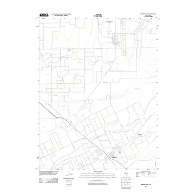
2012 Map of Wheatland
USGS Topo · Published 2012About this map
Wheatland serves as the primary hub in this corner of Yuba County, situated just north of the Bear River as it moves toward the Central Valley. The landscape is defined by an intricate network of waterways and irrigation paths, including Grasshopper Slough, Best Slough, and Dry Cr, which carve through the agricultural holdings of the region. Notable family operations such as Durst Ranch and Boardman Ranch are documented alongside transportation markers like Erle Siding.
Find a feature on this map
31 named features on this map. Tap any name to fly to it.
Don’t see what you’re looking for? This feature index may not catch every label — zoom into the map to look around manually.
Map Details
Editions of this 2012 Wheatland Map
This is the sole edition of this map. No revisions or reprints were ever made.
Other maps of this area

1888 · Marysville
USGS Topo · 1:125,000

1888 · Smartsville
USGS Topo · 1:125,000

1891 · Sacramento
USGS Topo · 1:125,000

1891 · Marysville
USGS Topo · 1:125,000

1891 · Smartsville
USGS Topo · 1:125,000

1892 · Sacramento
USGS Topo · 1:125,000

1892 · Smartsville
USGS Topo · 1:125,000

1893 · Sacramento
USGS Topo · 1:125,000

1894 · Smartsville
USGS Topo · 1:125,000

1894 · Marysville
USGS Topo · 1:125,000