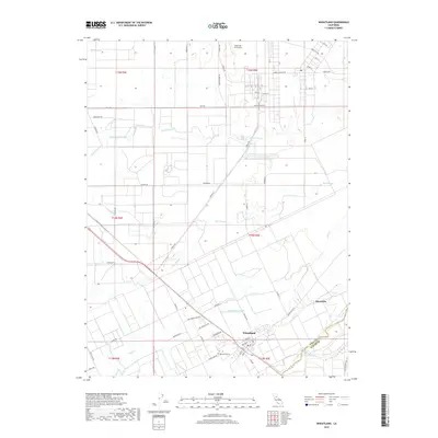
2018 Map of Wheatland
USGS Topo · Published 2018About this map
The Wheatland community and the southern edge of Beale Air Force Base define this landscape near the boundary of Yuba and Placer counties. This 2018 survey illustrates a complex hydrologic network where Dry Cr and Best Slough wind through the valley floor toward the Bear River. The grid of the settlement is centered around Mesa St and Main St, with the Wheatland Cem situated on the southern outskirts. To the northeast, the small settlement of Horstville sits near the crossing of Spenceville Rd. The map provides a detailed view of the infrastructure supporting both the military installation and the local agricultural community, including the levee systems along Grasshopper Slough and the numerous named local routes such as Ostrom Rd and S Beale Rd that connect the region's disparate residential and operational areas.
Find a feature on this map
50 named features on this map. Tap any name to fly to it.
Don’t see what you’re looking for? This feature index may not catch every label — zoom into the map to look around manually.
Map Details
Editions of this 2018 Wheatland Map
This is the sole edition of this map. No revisions or reprints were ever made.
Other maps of this area

1888 · Marysville
USGS Topo · 1:125,000

1888 · Smartsville
USGS Topo · 1:125,000

1891 · Sacramento
USGS Topo · 1:125,000

1891 · Marysville
USGS Topo · 1:125,000

1891 · Smartsville
USGS Topo · 1:125,000

1892 · Sacramento
USGS Topo · 1:125,000

1892 · Smartsville
USGS Topo · 1:125,000

1893 · Sacramento
USGS Topo · 1:125,000

1894 · Smartsville
USGS Topo · 1:125,000

1894 · Marysville
USGS Topo · 1:125,000