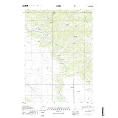
2020 Map of Wheaton Mountain
USGS Topo · Published 2020About this map
The Snake River winds through a deep canyon system in this portion of the Targhee National Forest, carving a landscape defined by significant elevation changes between the riverbed and the surrounding plateaus. Geologically and geographically, the area is marked by numerous named drainages such as Bear Gulch, Gormer Canyon, and Ladder Canyon, all feeding into the main river channel. Notable flatlands and benches, including Antelope Flat and Pine Creek Bench, provide a stark contrast to the steep walls of Black Canyon and Fisher Canyon. Historical use of the land is suggested by routes like the Old Ranger road and the naming of specific riparian areas like Fisher Bottom and Lufkin Bottom, which likely served as accessible points along the river's course. Numerous springs, such as Lufkin Spring and Warm Springs, indicate the presence of critical water sources in this high-elevation terrain.
Find a feature on this map
37 named features on this map. Tap any name to fly to it.
Don’t see what you’re looking for? This feature index may not catch every label — zoom into the map to look around manually.
Map Details
Editions of this 2020 Wheaton Mountain Map
This is the sole edition of this map. No revisions or reprints were ever made.
Other maps of this area

1924 · Hell Creek
USGS Topo · 1:62,500

1926 · Hell Creek
USGS Topo · 1:62,500

1932 · Irwin
USGS Topo · 1:96,000

1935 · Irwin
USGS Topo · 1:125,000

1943 · Garns Mtn
USGS Topo · 1:62,500

1946 · Garns Mtn
USGS Topo · 1:62,500

1951 · Hawley Gulch
USGS Topo · 1:24,000

1951 · Heise SE
USGS Topo · 1:24,000

1955 · Driggs
USGS Topo · 1:250,000

1958 · Driggs
USGS Topo · 1:250,000