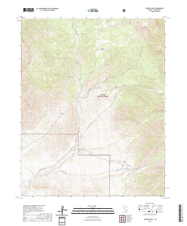
2021 Map of Wheeler Well
USGS Topo · Published 2021About this map
The Spring Mountains dominate this high-elevation landscape within the Toiyabe National Forest, where the arid environment of the Mojave Desert meets complex topographic relief. A network of backcountry routes, including Wheeler Pass Road and the Wheeler Pass Cutoff Road, reveals the historic transit corridors through this part of Clark County. These paths trace the natural drainage patterns of Wheeler Wash and provide access to vital water sources like Buck Spring and Rosebud Spring. Deep drainages such as Clark Canyon and Wallace Canyon further define the terrain. This modern survey documents the contemporary management of forest lands, preserving the alignment of traditional trails like the Bonanza Trail and the interconnected logging or mining roads that once supported remote mountain activities.
Find a feature on this map
19 named features on this map. Tap any name to fly to it.
Don’t see what you’re looking for? This feature index may not catch every label — zoom into the map to look around manually.
Map Details
Editions of this 2021 Wheeler Well Map
This is the sole edition of this map. No revisions or reprints were ever made.
Other maps of this area

1907 · Las Vegas
USGS Topo · 1:250,000

1908 · Las Vegas
USGS Topo · 1:250,000

1954 · Las Vegas
USGS Topo · 1:250,000

1957 · Las Vegas
USGS Topo · 1:250,000

1957 · Mt. Stirling
USGS Topo · 1:62,500

1957 · Charleston Peak
USGS Topo · 1:62,500

1957 · Mountain Springs
USGS Topo · 1:62,500
1958 · Pahrump
USGS Topo · 1:62,500

1959 · Las Vegas
USGS Topo · 1:250,000

1962 · Las Vegas
USGS Topo · 1:250,000