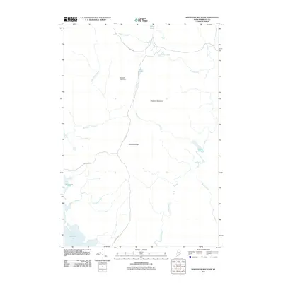
2011 Map of Whetstone Mountain
USGS Topo · Published 2011About this map
Whetstone Mountain and Kelloch Mountain dominate this part of the Maine North Woods, where the landscape is defined by its complex hydrography and logging road networks. The western portion of the quadrangle is largely occupied by the waters of Millinocket Lake, which feeds into smaller drainages like Little Mud Brook. Transportation in this unorganized territory relies on industrial arteries such as Stacyville Rd and Swift Brook Rd, which cut through the dense timberland to reach remote water bodies including Trout Pond and Soldier Pond. The drainage patterns are intricate, with Sandbank Stream and Meadow Brook winding through the low-lying areas between Millinocket Ridge and the neighboring peaks, illustrating the isolation and specialized land use of the Penobscot County interior during the early 21st century.
Find a feature on this map
16 named features on this map. Tap any name to fly to it.
Don’t see what you’re looking for? This feature index may not catch every label — zoom into the map to look around manually.
Map Details
Editions of this 2011 Whetstone Mountain Map
This is the sole edition of this map. No revisions or reprints were ever made.
Other maps of this area

1927 · Katahdin
USGS Topo · 1:48,000

1930 · Katahdin
USGS Topo · 1:62,500

1949 · Katahdin
USGS Topo · 1:62,500

1951 · Norcross
USGS Topo · 1:62,500

1951 · Millinocket
USGS Topo · 1:62,500

1953 · Stacyville
USGS Topo · 1:62,500

1954 · Millinocket
USGS Topo · 1:250,000

1958 · Millinocket
USGS Topo · 1:250,000

1960 · Millinocket
USGS Topo · 1:250,000
1975 · Stacyville NW
USGS Topo · 1:24,000