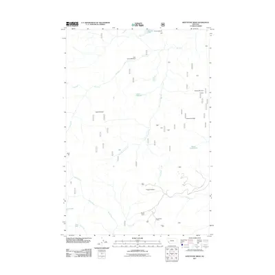
2011 Map of Whetstone Ridge
USGS Topo · Published 2011About this map
Miller Mine and the Montana Prince Mine anchor a pocket of historical mining activity in the southern reach of this Ravalli County landscape. This 2011 survey illustrates the high-elevation drainage patterns where the South Fork Rock Creek and Ross Fork originate. The map documents the concentration of small extraction sites like the Lutz Mine and O'Brien Mine near the headwaters of Cuba Creek. The terrain is defined by high peaks and ridges, including Moose Mountain and Whetstone Ridge, which separate various alpine basins and small water bodies. Named landmarks such as Cow Camp Meadows and Frogpond Basin provide evidence of historical land use, while Medicine Lake and Green Canyon Lake dot the mountain flanks, marking the origins of numerous creek systems.
Find a feature on this map
24 named features on this map. Tap any name to fly to it.
Don’t see what you’re looking for? This feature index may not catch every label — zoom into the map to look around manually.
Map Details
Editions of this 2011 Whetstone Ridge Map
This is the sole edition of this map. No revisions or reprints were ever made.
Other maps of this area

1909 · Sapphire
USGS Topo · 1:125,000

1947 · Butte
USGS Topo · 1:250,000

1955 · Dillon
USGS Topo · 1:250,000

1957 · Dillon
USGS Topo · 1:250,000

1958 · Butte
USGS Topo · 1:250,000

1958 · Dillon
USGS Topo · 1:250,000

1960 · Butte
USGS Topo · 1:250,000

1962 · Butte
USGS Topo · 1:250,000

1962 · Dillon
USGS Topo · 1:250,000

1965 · Dillon
USGS Topo · 1:250,000