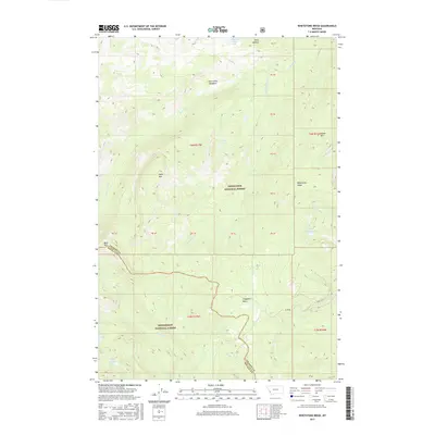
2017 Map of Whetstone Ridge
USGS Topo · Published 2017About this map
Cow Camp Meadows sits at the northern edge of this high-elevation landscape where the Deerlodge National Forest and Bitterroot National Forest meet. The terrain is defined by a series of prominent peaks and ridgelines, including Whetstone Ridge, Table Mtn, and Moose Mtn, which separate several high mountain basins. These basins contain numerous remote alpine water bodies such as Medicine Lake, Little Fish Lake, and Green Canyon Lake. The drainage network is complex, with the Ross Fork and S Fork Rock Cr carving paths through the granite-rich border between Ravalli and Granite counties. Road access is minimal, limited primarily to Co RD 80 and Co RD 5110, reflecting the wilderness character of this protected forest land.
Find a feature on this map
29 named features on this map. Tap any name to fly to it.
Don’t see what you’re looking for? This feature index may not catch every label — zoom into the map to look around manually.
Map Details
Editions of this 2017 Whetstone Ridge Map
This is the sole edition of this map. No revisions or reprints were ever made.
Other maps of this area

1909 · Sapphire
USGS Topo · 1:125,000

1947 · Butte
USGS Topo · 1:250,000

1955 · Dillon
USGS Topo · 1:250,000

1957 · Dillon
USGS Topo · 1:250,000

1958 · Butte
USGS Topo · 1:250,000

1958 · Dillon
USGS Topo · 1:250,000

1960 · Butte
USGS Topo · 1:250,000

1962 · Butte
USGS Topo · 1:250,000

1962 · Dillon
USGS Topo · 1:250,000

1965 · Dillon
USGS Topo · 1:250,000