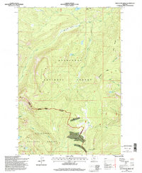
1996 Map of Whetstone Ridge
USGS Topo · Published 1998About this map
The boundary between Granite and Ravalli counties bisects this high-elevation landscape, where the Deerlodge National Forest meets the Bitterroot National Forest. This 1990s record of the terrain shows a history of alpine mining activity concentrated around Frogpond Basin and the southern slopes of Whetstone Ridge. While many of these locations are only accessible by trail or four-wheel-drive road, the presence of named claims such as the Montana Prince Mine, Millers Mine, and Lutz Mine points to a legacy of mineral exploration in the shadow of Table Mountain. Drainage systems define the map, from Ross Fork Rock Creek in the north to Moose Creek in the south, feeding a series of small mountain lakes including Medicine Lake and Little Fish Lake.
Find a feature on this map
32 named features on this map. Tap any name to fly to it.
Don’t see what you’re looking for? This feature index may not catch every label — zoom into the map to look around manually.
Map Details
Editions of this 1996 Whetstone Ridge Map
This is the sole edition of this map. No revisions or reprints were ever made.
Other maps of this area

1909 · Sapphire
USGS Topo · 1:125,000

1947 · Butte
USGS Topo · 1:250,000

1955 · Dillon
USGS Topo · 1:250,000

1957 · Dillon
USGS Topo · 1:250,000

1958 · Butte
USGS Topo · 1:250,000

1958 · Dillon
USGS Topo · 1:250,000

1960 · Butte
USGS Topo · 1:250,000

1962 · Butte
USGS Topo · 1:250,000

1962 · Dillon
USGS Topo · 1:250,000

1965 · Dillon
USGS Topo · 1:250,000