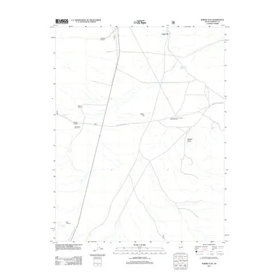
2011 Map of Whisky Flat
USGS Topo · Published 2011About this map
Qualeys Camp and Jaggersville anchor this high-desert landscape in Mineral County, reflecting the sparse, utilitarian settlement patterns of the western Great Basin. The terrain is defined by the broad expanse of Whisky Flat, which is bounded by several drainage systems including Johnston Canyon, Jim Canyon, and Box Canyon. The cattle-ranching heritage of the region is evident through specialized labels like the Whiskey Flat Holding Corral and the Sweetwater Ranch Company Whisky Flat Unit. Water remains the most critical resource for these operations, documented here by Whisky Spring, Large Williams Spring, and the Whisky Flat Reservoir. Movement across this arid stretch relies on a network of unpaved tracks such as Sweetwater Ranch Rd and Whiskey Flat Ranch Rd, which connect isolated camps and grazing units to the wider Nevada desert.
Find a feature on this map
15 named features on this map. Tap any name to fly to it.
Don’t see what you’re looking for? This feature index may not catch every label — zoom into the map to look around manually.
Map Details
Editions of this 2011 Whisky Flat Map
This is the sole edition of this map. No revisions or reprints were ever made.
Other maps of this area

1909 · Hawthorne
USGS Topo · 1:250,000

1911 · Hawthorne
USGS Topo · 1:250,000

1915 · Hawthorne
USGS Topo · 1:250,000

1948 · Walker Lake
USGS Topo · 1:250,000

1955 · Powell Mtn
USGS Topo · 1:62,500

1957 · Walker Lake
USGS Topo · 1:250,000

1958 · Huntoon Valley
USGS Topo · 1:62,500

1962 · Walker Lake
USGS Topo · 1:250,000

1964 · Walker Lake
USGS Topo · 1:250,000

1967 · Pamlico
USGS Topo · 1:24,000