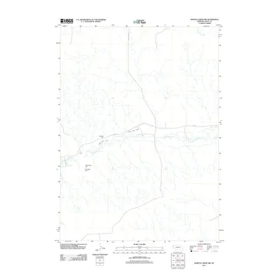
2011 Map of Whistle Creek NW
USGS Topo · Published 2011About this map
The Niobrara River winds through this section of Sioux County, where human engineering meets the high plains landscape. The Harris Neece Canal runs parallel to the river's northern bank, supported by the Skavdahl Dam, illustrating the intricate water management required for Nebraska ranching and agriculture. The terrain is marked by distinctive elevations such as University Hill and Carnegie Hill, which rise above the surrounding drainage basins of Barngrover Creek. Local transportation is defined by rural routes like Johnson Drive Rd and River Rd, which provide access to this sparsely populated region near the Wyoming border. This survey details the remote cattle country and water infrastructure that sustained the Whistle Creek area in the early twenty-first century.
Find a feature on this map
8 named features on this map. Tap any name to fly to it.
Don’t see what you’re looking for? This feature index may not catch every label — zoom into the map to look around manually.
Map Details
Editions of this 2011 Whistle Creek NW Map
This is the sole edition of this map. No revisions or reprints were ever made.
Other maps of this area

1899 · Whistle Creek
USGS Topo · 1:125,000

1955 · Alliance
USGS Topo · 1:250,000

1957 · Alliance
USGS Topo · 1:250,000

1958 · Alliance
USGS Topo · 1:250,000

1979 · Harrison SE
USGS Topo · 1:24,000

1979 · Mount Edna
USGS Topo · 1:24,000

1979 · Agate
USGS Topo · 1:24,000

1980 · Kyle Creek
USGS Topo · 1:24,000
1980 · Glen
USGS Topo · 1:24,000
1983 · Whistle Creek NW
USGS Topo · 1:24,000