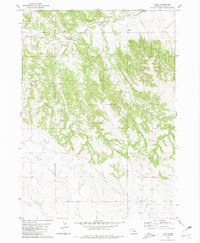
1980 Map of Glen
USGS Topo · Published 1981About this map
Glen and the surrounding high plains of Sioux County are defined by a complex network of seasonal drainages and the northern reach of the White River. The landscape is etched by Deep Creek, Spring Creek, and Bull Creek, creating a broken topography that dictated the placement of early infrastructure. The Chicago and North Western railroad cuts across the northern edge of this terrain, following the easier grades of the river valley. Local community life is anchored by the District No 33 Sch and the Glendale Cem, providing tangible points of interest for those researching the rural settlement patterns of western Nebraska. The interplay between the iron rails and these remote outposts illustrates the 20th-century transition from isolated ranching pockets to a more connected regional economy.
Find a feature on this map
9 named features on this map. Tap any name to fly to it.
Don’t see what you’re looking for? This feature index may not catch every label — zoom into the map to look around manually.
Map Details
Editions of this 1980 Glen Map
This is the sole edition of this map. No revisions or reprints were ever made.
Other maps of this area

1899 · Whistle Creek
USGS Topo · 1:125,000

1951 · Marsland
USGS Topo · 1:62,500

1955 · Alliance
USGS Topo · 1:250,000

1957 · Alliance
USGS Topo · 1:250,000

1958 · Alliance
USGS Topo · 1:250,000

1980 · Kyle Creek
USGS Topo · 1:24,000

1980 · Smiley Canyon
USGS Topo · 1:24,000

1980 · Andrews
USGS Topo · 1:24,000

1980 · Dead Mans Creek
USGS Topo · 1:24,000
1980 · Crawford
USGS Topo · 1:24,000