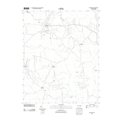
2010 Map of Whitakers
USGS Topo · Published 2010About this map
Whitakers and Battleboro anchor this rural North Carolina landscape, where the agricultural traditions of the coastal plain are traced through a dense network of family cemeteries and crossroad settlements. The area is defined by the winding course of Swift Creek and the expansive White Oak Swamp, which dictate the placement of early infrastructure like Seven Bridges Rd and Taylor's Feed Mill Ln. For genealogists, the map is a significant record of local lineage, documenting numerous burial sites such as Tyler Cemetery, Jerusalem Cemetery, and Phillips Cemetery. These landmarks, along with established community centers like Gethsemane and Cherry Crossroads, reflect a decentralized social structure built around family landholdings and small-scale processing hubs.
Find a feature on this map
52 named features on this map. Tap any name to fly to it.
Don’t see what you’re looking for? This feature index may not catch every label — zoom into the map to look around manually.
Map Details
Editions of this 2010 Whitakers Map
This is the sole edition of this map. No revisions or reprints were ever made.
Other maps of this area

1902 · Rocky Mount
USGS Topo · 1:62,500

1902 · Tarboro
USGS Topo · 1:62,500

1903 · Tarboro
USGS Topo · 1:62,500

1904 · Rocky Mount
USGS Topo · 1:62,500

1953 · Norfolk
USGS Topo · 1:250,000

1953 · Rocky Mount
USGS Topo · 1:250,000

1954 · Rocky Mount
USGS Topo · 1:250,000

1960 · Dawson Crossroads
USGS Topo · 1:24,000

1960 · Draughn
USGS Topo · 1:24,000

1961 · Whitakers
USGS Topo · 1:24,000