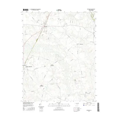
2016 Map of Whitakers
USGS Topo · Published 2016About this map
Whitakers and Battleboro anchor this rural landscape along the border of Nash, Edgecombe, and Halifax counties, showing the transition from traditional farming to modern infrastructure. The area is defined by its extensive wetlands, notably the White Oak Swamp and Mane Swamp, which are channeled into waterways like the Doggett Canal. For genealogists, the map is remarkably dense with family-named landmarks and resting places, ranging from the Tyler Cem in the north to the Lawrence Cem near Moccasin Cr. Small communities such as Gethsemane and Cherry Crossroads sit at the intersections of historic local routes like Seven Bridges Rd and Speights Chapel Rd. Industrial and transportation history is visible in the alignment of NE Railroad St and SE Railroad St, alongside the small-scale aviation of Thompson Farms Airport.
Find a feature on this map
75 named features on this map. Tap any name to fly to it.
Don’t see what you’re looking for? This feature index may not catch every label — zoom into the map to look around manually.
Map Details
Editions of this 2016 Whitakers Map
This is the sole edition of this map. No revisions or reprints were ever made.
Other maps of this area

1902 · Rocky Mount
USGS Topo · 1:62,500

1902 · Tarboro
USGS Topo · 1:62,500

1903 · Tarboro
USGS Topo · 1:62,500

1904 · Rocky Mount
USGS Topo · 1:62,500

1953 · Norfolk
USGS Topo · 1:250,000

1953 · Rocky Mount
USGS Topo · 1:250,000

1954 · Rocky Mount
USGS Topo · 1:250,000

1960 · Dawson Crossroads
USGS Topo · 1:24,000

1960 · Draughn
USGS Topo · 1:24,000

1961 · Whitakers
USGS Topo · 1:24,000