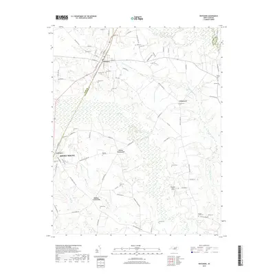
2019 Map of Whitakers
USGS Topo · Published 2019About this map
White Oak Swamp and Swift Cr dominate the low-lying drainage patterns between the borderlands of Nash and Edgecombe counties. The town of Whitakers serves as a local hub along the rail corridor, with NE Railroad St Exd and SE Railroad St marking the town's industrial and transport origins. The landscape is characterized by a dense network of family-named landmarks and rural burial grounds, such as Jerusalem Cem, Carlyle Cem, and Morning Star Cem. These small cemeteries are often found near local intersections like Cherry Crossroads and Phillips Crossroads, which highlight the historical settlement pattern of the North Carolina coastal plain. Agriculture and transit remain central to the region, evidenced by the presence of Thompson Farms Airport and the numerous farm-to-market roads like Taylors Feed Mill Ln and Etheridge Farm Rd.
Find a feature on this map
79 named features on this map. Tap any name to fly to it.
Don’t see what you’re looking for? This feature index may not catch every label — zoom into the map to look around manually.
Map Details
Editions of this 2019 Whitakers Map
This is the sole edition of this map. No revisions or reprints were ever made.
Other maps of this area

1902 · Rocky Mount
USGS Topo · 1:62,500

1902 · Tarboro
USGS Topo · 1:62,500

1903 · Tarboro
USGS Topo · 1:62,500

1904 · Rocky Mount
USGS Topo · 1:62,500

1953 · Norfolk
USGS Topo · 1:250,000

1953 · Rocky Mount
USGS Topo · 1:250,000

1954 · Rocky Mount
USGS Topo · 1:250,000

1960 · Dawson Crossroads
USGS Topo · 1:24,000

1960 · Draughn
USGS Topo · 1:24,000

1961 · Whitakers
USGS Topo · 1:24,000