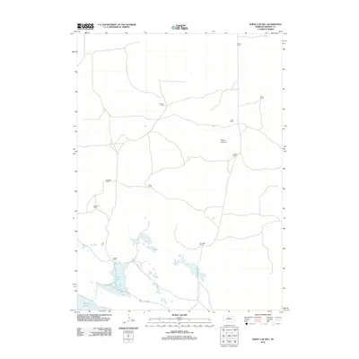
2011 Map of White Cap Hill
USGS Topo · Published 2011About this map
Alkali Lake and the nearby Moon Lake anchor the southern reaches of this landscape in Brown County, Nebraska. This high-plains terrain is defined by a sparse but interconnected network of named family outposts and ranch lands. The topography is dominated by the prominent elevation of White Cap Hill, which overlooks a series of remote camps and homesteads.
Find a feature on this map
13 named features on this map. Tap any name to fly to it.
Don’t see what you’re looking for? This feature index may not catch every label — zoom into the map to look around manually.
Map Details
Editions of this 2011 White Cap Hill Map
This is the sole edition of this map. No revisions or reprints were ever made.
Other maps of this area

1950 · Wood Lake
USGS Topo · 1:62,500

1951 · Moon Lake
USGS Topo · 1:62,500

1954 · Ainsworth SW
USGS Topo · 1:24,000

1955 · O'Neill
USGS Topo · 1:250,000

1957 · Valentine
USGS Topo · 1:250,000

1959 · Valentine
USGS Topo · 1:250,000

1959 · O'Neill
USGS Topo · 1:250,000

1969 · O'Neill
USGS Topo · 1:250,000

1982 · Lost Lake Ranch
USGS Topo · 1:24,000
1982 · Raven SW
USGS Topo · 1:24,000