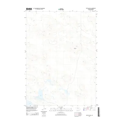
2014 Map of White Cap Hill
USGS Topo · Published 2014About this map
White Cap Hill rises above the sandhills of northern Nebraska, anchoring a landscape defined by isolated basins and seasonal water bodies. This 2014 survey by the U.S. Geological Survey captures the remote character of Brown County, where large alkali-rich depressions like Alkali Lake and Moon Lake collect in the low-lying terrain between stabilized dunes. The lack of structured settlements or through-roads on this sheet emphasizes the sparse, open nature of the Nebraska Sandhills, a region where topographical features and water sources serve as the primary landmarks for land management and navigation.
Find a feature on this map
3 named features on this map. Tap any name to fly to it.
Don’t see what you’re looking for? This feature index may not catch every label — zoom into the map to look around manually.
Map Details
Editions of this 2014 White Cap Hill Map
This is the sole edition of this map. No revisions or reprints were ever made.
Other maps of this area

1950 · Wood Lake
USGS Topo · 1:62,500

1951 · Moon Lake
USGS Topo · 1:62,500

1954 · Ainsworth SW
USGS Topo · 1:24,000

1955 · O'Neill
USGS Topo · 1:250,000

1957 · Valentine
USGS Topo · 1:250,000

1959 · Valentine
USGS Topo · 1:250,000

1959 · O'Neill
USGS Topo · 1:250,000

1969 · O'Neill
USGS Topo · 1:250,000

1982 · Lost Lake Ranch
USGS Topo · 1:24,000
1982 · Raven SW
USGS Topo · 1:24,000