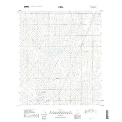
2018 Map of White City
USGS Topo · Published 2018About this map
The Intracoastal Waterway cuts through the Gulf County landscape, serving as a primary artery for maritime commerce south of the White City settlement. This coastal region is defined by a dense network of timber and access roads, including several routes associated with the St Joe Paper Company Rd, illustrating the region's industrial ties to the paper and pulp industry. The residential layout of White City is visible along the waterway, connected to the surrounding wetlands and drainage systems of Cypress Creek and Whitfield Slough. Local infrastructure such as Bayless Bridge and the uniquely named Old Dynamite Dock Rd provide specific points of interest for those tracing the historical development of transit and industry in the Florida panhandle. The terrain is characterized by low-lying marshes and a complex web of forest roads, including Doc Whitfield Rd and Cecil G Costin, Sr Blvd, which navigate the interior swamps.
Find a feature on this map
39 named features on this map. Tap any name to fly to it.
Don’t see what you’re looking for? This feature index may not catch every label — zoom into the map to look around manually.
Map Details
Editions of this 2018 White City Map
This is the sole edition of this map. No revisions or reprints were ever made.
Other maps of this area

1943 · Port St. Joe
USGS Topo · 1:31,680

1943 · Overstreet
USGS Topo · 1:31,680

1943 · Jackson River
USGS Topo · 1:24,000

1944 · White City
USGS Topo · 1:24,000

1944 · Forbes Island
USGS Topo · 1:24,000

1945 · Forbes Island
USGS Topo · 1:31,680

1945 · Lake Wimico
USGS Topo · 1:31,680

1945 · Kennedy Creek
USGS Topo · 1:31,680

1945 · White City
USGS Topo · 1:31,680

1945 · Wewahitchka
USGS Topo · 1:31,680