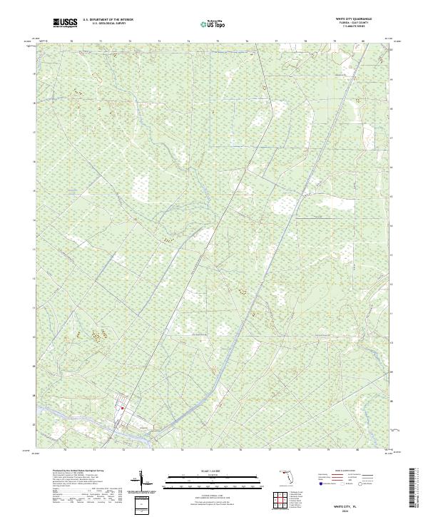
2024 Map of White City
USGS Topo · Published 2024About this map
The Intracoastal Waterway cuts through the southern landscape of Gulf County, anchoring the transportation and water network of this coastal region. To the north, the terrain is defined by a complex of wetlands and drainage patterns, including the winding Whitfield Slough, Luke Ford Creek, and Cypress Creek. The transition from the natural water bodies to the managed landscape is evident in the dense network of forest roads and corridors, such as St Joe Paper Company Rd and Camp Nelly Grade Rd, reflecting the area's history of timber and paper production. Residential patterns begin to cluster in the south near W Beatty Ave and Wimico Dr, where street names like Charles Ave and Stebel Dr suggest local family connections and community development just above the canal.
Find a feature on this map
42 named features on this map. Tap any name to fly to it.
Don’t see what you’re looking for? This feature index may not catch every label — zoom into the map to look around manually.
Map Details
Editions of this 2024 White City Map
This is the sole edition of this map. No revisions or reprints were ever made.
Other maps of this area

1943 · Port St. Joe
USGS Topo · 1:31,680

1943 · Overstreet
USGS Topo · 1:31,680

1943 · Jackson River
USGS Topo · 1:24,000

1944 · White City
USGS Topo · 1:24,000

1944 · Forbes Island
USGS Topo · 1:24,000

1945 · Forbes Island
USGS Topo · 1:31,680

1945 · Lake Wimico
USGS Topo · 1:31,680

1945 · Kennedy Creek
USGS Topo · 1:31,680

1945 · White City
USGS Topo · 1:31,680

1945 · Wewahitchka
USGS Topo · 1:31,680