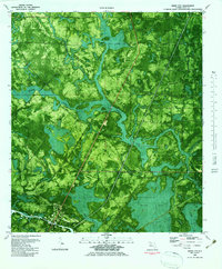
1982 Map of White City
USGS Topo · Published 1983About this map
White City sits at the southern edge of this Florida panhandle landscape, positioned where the Intracoastal Waterway cuts through the marshy terrain of Gulf County. This orthophotomap, based on aerial photography from the mid-1970s, reveals a complex network of wetlands and tidal drainage patterns. A series of water bodies, including Whitfield Slough, Rudy Bay, and Lake Fort, dominate the north and east, connected by minor arteries like Cypress Creek and Possum Branch. The landscape is largely defined by these low-lying hydrological features, with Howard Road providing one of the few established terrestrial routes across the southern section. A Lookout Tower stands as a notable landmark in the interior, likely once utilized for fire surveillance over the dense vegetation. The map provides a high-resolution visual of the land-use transition from the settlement at White City to the surrounding coastal wetlands and drainage branches like Bailey Branch and Foy Branch.
Find a feature on this map
13 named features on this map. Tap any name to fly to it.
Don’t see what you’re looking for? This feature index may not catch every label — zoom into the map to look around manually.
Map Details
Editions of this 1982 White City Map
This is the sole edition of this map. No revisions or reprints were ever made.
Other maps of this area

1943 · Port St. Joe
USGS Topo · 1:31,680

1943 · Overstreet
USGS Topo · 1:31,680

1943 · Jackson River
USGS Topo · 1:24,000

1944 · White City
USGS Topo · 1:24,000

1944 · Forbes Island
USGS Topo · 1:24,000

1945 · Forbes Island
USGS Topo · 1:31,680

1945 · Lake Wimico
USGS Topo · 1:31,680

1945 · Kennedy Creek
USGS Topo · 1:31,680

1945 · White City
USGS Topo · 1:31,680

1945 · Wewahitchka
USGS Topo · 1:31,680