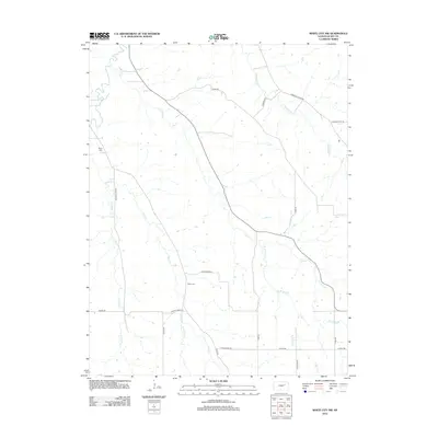
2012 Map of White City NW
USGS Topo · Published 2012About this map
Clarks Cr and Dry Cr weave through this section of Geary County, defining a landscape of creek-bottom roads and upland ridges. The rural character of the area is evident in the network of family-named thoroughfares such as Schmedemann Rd, Dierndigger Rd, and Swenson Rd, which connect isolated homesteads and farmland. For those researching local lineages, the map identifies Rosey Cem near the western edge and Olson Cem centrally located near the confluence of Thomas Cr and Davis Cr. The intricate drainage patterns of the W Br Dry Cr and W Br Davis Cr highlight the reliance on natural watercourses for early settlement placement and boundary orientation in the Kansas interior.
Find a feature on this map
23 named features on this map. Tap any name to fly to it.
Don’t see what you’re looking for? This feature index may not catch every label — zoom into the map to look around manually.
Map Details
Editions of this 2012 White City NW Map
This is the sole edition of this map. No revisions or reprints were ever made.
Other maps of this area

1886 · Junction City
USGS Topo · 1:125,000

1889 · Junction City
USGS Topo · 1:125,000

1889 · Parkerville
USGS Topo · 1:125,000

1894 · Junction City
USGS Topo · 1:125,000

1894 · Parkerville
USGS Topo · 1:125,000

1947 · Manhattan
USGS Topo · 1:62,500

1947 · Fort Riley
USGS Topo · 1:62,500

1950 · Junction City
USGS Topo · 1:24,000

1951 · Swede Creek
USGS Topo · 1:24,000

1951 · Ogden
USGS Topo · 1:24,000