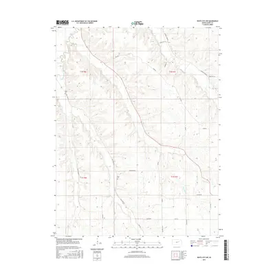
2015 Map of White City NW
USGS Topo · Published 2015About this map
Clarks Creek and Humboldt Cr carve through this section of Geary County, defining a landscape of drainage basins and upland ridges. The rural character of the area is anchored by small, local landmarks like Olson Cem and Rosey Cem, providing valuable points of reference for those tracing family history in this part of Kansas. The terrain is a complex network of waterways, including Davis Cr, Thomas Cr, and the branches of Dry Cr, which shaped the placement of early routes. A grid of named roads, such as Ridge Rd, Burley Hill Rd, and Derendinger Rd, follows the section lines and topography, illustrating the enduring township and range system that organized settlement across t12s r6e and surrounding ranges.
Find a feature on this map
30 named features on this map. Tap any name to fly to it.
Don’t see what you’re looking for? This feature index may not catch every label — zoom into the map to look around manually.
Map Details
Editions of this 2015 White City NW Map
This is the sole edition of this map. No revisions or reprints were ever made.
Other maps of this area

1886 · Junction City
USGS Topo · 1:125,000

1889 · Junction City
USGS Topo · 1:125,000

1889 · Parkerville
USGS Topo · 1:125,000

1894 · Junction City
USGS Topo · 1:125,000

1894 · Parkerville
USGS Topo · 1:125,000

1947 · Manhattan
USGS Topo · 1:62,500

1947 · Fort Riley
USGS Topo · 1:62,500

1950 · Junction City
USGS Topo · 1:24,000

1951 · Swede Creek
USGS Topo · 1:24,000

1951 · Ogden
USGS Topo · 1:24,000