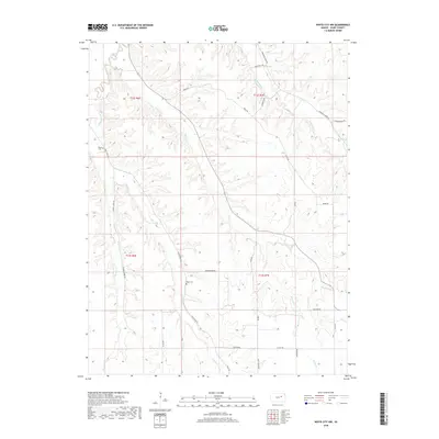
2018 Map of White City NW
USGS Topo · Published 2018About this map
Clarks Creek and Humboldt Cr carve through the Geary County landscape, creating a network of drainage basins that define the local topography. This 2018 survey documents a region dominated by these seasonal and perennial waterways, including Thomas Cr and Davis Cr. The cultural imprint is concentrated along section-line roads, where small landmarks like Rosey Cem and Olson Cem stand as points of interest for genealogists tracing family histories in this rural pocket. The map illustrates a transition between higher elevations at Burley Hill Rd and Ridge Rd down into the narrow valleys formed by the W Br Dry Cr and W Br Illinois Cr, showing how the modern road network follows the ridges and creek crossings established by early land divisions.
Find a feature on this map
29 named features on this map. Tap any name to fly to it.
Don’t see what you’re looking for? This feature index may not catch every label — zoom into the map to look around manually.
Map Details
Editions of this 2018 White City NW Map
This is the sole edition of this map. No revisions or reprints were ever made.
Other maps of this area

1886 · Junction City
USGS Topo · 1:125,000

1889 · Junction City
USGS Topo · 1:125,000

1889 · Parkerville
USGS Topo · 1:125,000

1894 · Junction City
USGS Topo · 1:125,000

1894 · Parkerville
USGS Topo · 1:125,000

1947 · Manhattan
USGS Topo · 1:62,500

1947 · Fort Riley
USGS Topo · 1:62,500

1950 · Junction City
USGS Topo · 1:24,000

1951 · Swede Creek
USGS Topo · 1:24,000

1951 · Ogden
USGS Topo · 1:24,000