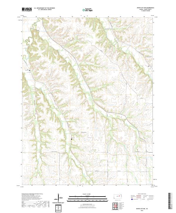
2022 Map of White City NW
USGS Topo · Published 2022About this map
Clarks Creek and Humboldt Cr define the drainage patterns of this rural landscape in Geary County, where a network of tributary streams including Dry Cr, Thomas Cr, and Davis Cr carve through the high ground. The area's agricultural and social history is anchored by local landmarks such as Davis Creek Cem and Olson Cem, which serve as quiet markers of the families who settled this prairie. Modern travel follows long-established routes like Ridge Rd and Burley Hill Rd, tracing the natural topography between the various forks of the creek systems. The map detail highlights the intricate water network, including W Br Dry Cr and W Br Illinois Cr, illustrating the transition from upland ridges to fertile valley floors.
Find a feature on this map
28 named features on this map. Tap any name to fly to it.
Don’t see what you’re looking for? This feature index may not catch every label — zoom into the map to look around manually.
Map Details
Editions of this 2022 White City NW Map
This is the sole edition of this map. No revisions or reprints were ever made.
Other maps of this area

1886 · Junction City
USGS Topo · 1:125,000

1889 · Junction City
USGS Topo · 1:125,000

1889 · Parkerville
USGS Topo · 1:125,000

1894 · Junction City
USGS Topo · 1:125,000

1894 · Parkerville
USGS Topo · 1:125,000

1947 · Manhattan
USGS Topo · 1:62,500

1947 · Fort Riley
USGS Topo · 1:62,500

1950 · Junction City
USGS Topo · 1:24,000

1951 · Swede Creek
USGS Topo · 1:24,000

1951 · Ogden
USGS Topo · 1:24,000