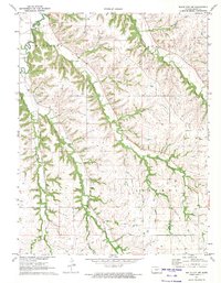
1971 Map of White City NW
USGS Topo · Published 1974About this map
The rolling hills of Geary County are deeply incised by a drainage network feeding into Clarks Creek and Humboldt Creek during the early 1970s. This rural landscape is defined by its townships, with Jefferson, Wingfield, Blakely, and Liberty dividing the territory. The map provides significant detail for local historians, including the specific locations of Olson Cem and Rosey Cem, along with unnamed cemeteries that speak to the generational settlement of these Kansas uplands. Resource extraction is evident through a Quarry and various Quarries located in the southern sections, likely utilizing the limestone or shale layers of the Flint Hills region. Numerous tributaries like Dry Creek, Thomas Creek, and Davis Creek illustrate the natural topography that dictated the placement of early farmsteads and field boundaries.
Find a feature on this map
16 named features on this map. Tap any name to fly to it.
Don’t see what you’re looking for? This feature index may not catch every label — zoom into the map to look around manually.
Map Details
Editions of this 1971 White City NW Map
This is the sole edition of this map. No revisions or reprints were ever made.
Other maps of this area

1886 · Junction City
USGS Topo · 1:125,000

1889 · Junction City
USGS Topo · 1:125,000

1889 · Parkerville
USGS Topo · 1:125,000

1894 · Junction City
USGS Topo · 1:125,000

1894 · Parkerville
USGS Topo · 1:125,000

1947 · Manhattan
USGS Topo · 1:62,500

1947 · Fort Riley
USGS Topo · 1:62,500

1950 · Junction City
USGS Topo · 1:24,000

1951 · Swede Creek
USGS Topo · 1:24,000

1951 · Ogden
USGS Topo · 1:24,000