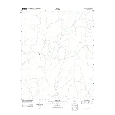
2011 Map of White Clay
USGS Topo · Published 2011About this map
White Clay sits at a geographic crossroads in Apache County, defined by the winding drainages that feed the desert floor. The northern reach of the Canyon De Chelly Natl Monument extends into this area, marking a landscape where high-desert hydrology dictates the placement of essential resources. Important water features like Whiskey Reservoir and the isolated Yellowhair Spring provide critical watering points within a network of ephemeral streambeds, including Coyote Wash and Cattail Wash. This map documents a modern infrastructure of tribal routes, with Indian Rte 8073 and Indian Rte 9702 weaving through the terrain. These roads and seasonal washes illustrate the traditional and modern movement of people across the Chinle Agency lands, connecting remote homesteads and seasonal grazing areas near Whiskey Creek.
Find a feature on this map
11 named features on this map. Tap any name to fly to it.
Don’t see what you’re looking for? This feature index may not catch every label — zoom into the map to look around manually.
Map Details
Editions of this 2011 White Clay Map
This is the sole edition of this map. No revisions or reprints were ever made.
Other maps of this area

1886 · Fort Defiance
USGS Topo · 1:250,000

1892 · Fort Defiance
USGS Topo · 1:250,000

1892 · Canyon De Chelly
USGS Topo · 1:250,000

1954 · Shiprock
USGS Topo · 1:250,000

1954 · Gallup
USGS Topo · 1:250,000

1955 · Zith-Tusayan Butte 2 NE
USGS Topo · 1:24,000

1955 · Sonsala Butte 4 SE
USGS Topo · 1:24,000

1955 · Sonsala Butte 4 NW
USGS Topo · 1:24,000

1955 · Sonsala Butte 3 SE
USGS Topo · 1:24,000
1955 · Zith-Tusayan Butte 1 NE
USGS Topo · 1:24,000