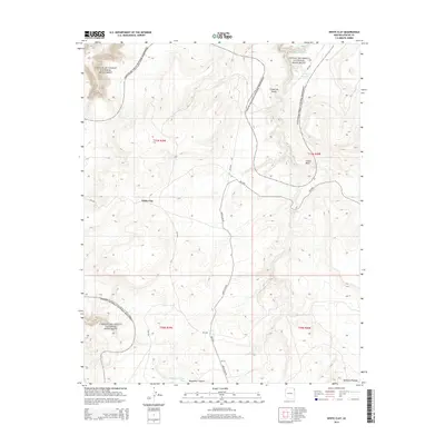
2014 Map of White Clay
USGS Topo · Published 2014About this map
White Clay Rd serves as the primary artery through this high-altitude landscape of the Defiance Plateau, leading to the small settlement of White Clay. This 2014 survey documents a rugged corner of the Navajo Nation where the western and northern boundaries are defined by the protected reaches of the Canyon De Chelly National Monument. The topography is marked by deep drainage systems and high ridges, punctuated by specific water sources like Yellowhair Spring and the Whiskey Reservoir.
Find a feature on this map
13 named features on this map. Tap any name to fly to it.
Don’t see what you’re looking for? This feature index may not catch every label — zoom into the map to look around manually.
Map Details
Editions of this 2014 White Clay Map
This is the sole edition of this map. No revisions or reprints were ever made.
Other maps of this area

1886 · Fort Defiance
USGS Topo · 1:250,000

1892 · Fort Defiance
USGS Topo · 1:250,000

1892 · Canyon De Chelly
USGS Topo · 1:250,000

1954 · Shiprock
USGS Topo · 1:250,000

1954 · Gallup
USGS Topo · 1:250,000

1955 · Zith-Tusayan Butte 2 NE
USGS Topo · 1:24,000

1955 · Sonsala Butte 4 SE
USGS Topo · 1:24,000

1955 · Sonsala Butte 4 NW
USGS Topo · 1:24,000

1955 · Sonsala Butte 3 SE
USGS Topo · 1:24,000
1955 · Zith-Tusayan Butte 1 NE
USGS Topo · 1:24,000