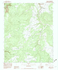
1983 Map of White Clay
USGS Topo · Published 1983About this map
Canyon de Chelly National Monument and the Navajo Indian Reservation define the rugged geography of this high-desert region in northeastern Arizona. The landscape is marked by deep drainage systems including Whiskey Creek, Coyote Wash, and Catloit Wash, which cut through the sandstone plateaus toward the canyon depths. Human presence is documented through sparse but significant infrastructure such as the White Clay Windmill and scattered Corrals, illustrating the traditional pastoral land use of the area in the late twentieth century.
Find a feature on this map
19 named features on this map. Tap any name to fly to it.
Don’t see what you’re looking for? This feature index may not catch every label — zoom into the map to look around manually.
Map Details
Editions of this 1983 White Clay Map
This is the sole edition of this map. No revisions or reprints were ever made.
Other maps of this area

1886 · Fort Defiance
USGS Topo · 1:250,000

1892 · Fort Defiance
USGS Topo · 1:250,000

1892 · Canyon De Chelly
USGS Topo · 1:250,000

1954 · Shiprock
USGS Topo · 1:250,000

1954 · Gallup
USGS Topo · 1:250,000

1955 · Zith-Tusayan Butte 2 NE
USGS Topo · 1:24,000

1955 · Sonsala Butte 4 SE
USGS Topo · 1:24,000

1955 · Sonsala Butte 4 NW
USGS Topo · 1:24,000

1955 · Sonsala Butte 3 SE
USGS Topo · 1:24,000
1955 · Zith-Tusayan Butte 1 NE
USGS Topo · 1:24,000