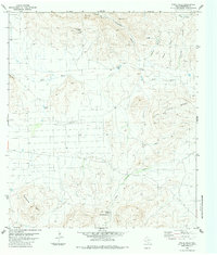
1983 Map of White Hills
USGS Topo · Published 1984About this map
Nine Point Mesa and Jack Eden Mesa dominate this high-desert landscape in Brewster County, where 1970s photogrammetric surveys captured a remote ranching and transit environment. The reliance on scattered water sources is evident through named features like Cottonwood Spring, Little Corazones Spring, and the Alamo Windmill. A prominent Pipeline and a remote Landing Strip cut across the arid terrain, illustrating the modern industrial infrastructure required to service this isolated portion of West Texas. Drainage patterns are defined by the winding Nine Point Draw and Corazones Draw, which provide the primary relief among the elevated plateaus of Eastwood Mesa and the White Hills. This map serves as a detailed record of land use in a region where survival is tied to the management of scarce resources and the maintenance of long-distance utility corridors.
Find a feature on this map
18 named features on this map. Tap any name to fly to it.
Don’t see what you’re looking for? This feature index may not catch every label — zoom into the map to look around manually.
Map Details
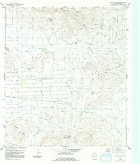
Editions of this 1983 White Hills Map
2 editions found
Other maps of this area

1903 · Chisos Mountains
USGS Topo · 1:125,000

1903 · Terlingua
USGS Topo · 1:125,000

1904 · Terlingua
USGS Topo · 1:125,000

1905 · Chisos Mountains
USGS Topo · 1:125,000

1917 · Agua Fria
USGS Topo · 1:62,500

1918 · Bone Spring
USGS Topo · 1:125,000

1918 · Nine Point Mesa
USGS Topo · 1:62,500

1937 · Nine Point Mesa
USGS Topo · 1:62,500

1937 · Agua Fria
USGS Topo · 1:62,500

1959 · Emory Peak
USGS Topo · 1:250,000