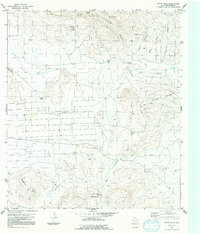
1983 Map of White Hills
USGS Topo · Published 1991About this map
Nine Point Mesa and Jack Eden Mesa dominate this high-desert landscape of Brewster County, revealing a mid-20th-century infrastructure built around water and aviation. The presence of a Landing Strip and a long Pipeline cutting through Cartwright Canyon suggests the logistical demands of ranching or mineral exploration in this arid reach. Water sources, vital for survival in this terrain, are carefully documented through remote features like Alamo Windmill, Tony Windmill, and Double Tanks. The drainage patterns of the Nine Point Draw and West Corazones Draw define the topography between the mesa heights and the White Hills, providing a clear record of the area's natural landmarks as they were recorded in the 1970s and 1980s.
Find a feature on this map
20 named features on this map. Tap any name to fly to it.
Don’t see what you’re looking for? This feature index may not catch every label — zoom into the map to look around manually.
Map Details
Editions of this 1983 White Hills Map
2 editions found
Other maps of this area

1903 · Chisos Mountains
USGS Topo · 1:125,000

1903 · Terlingua
USGS Topo · 1:125,000

1904 · Terlingua
USGS Topo · 1:125,000

1905 · Chisos Mountains
USGS Topo · 1:125,000

1917 · Agua Fria
USGS Topo · 1:62,500

1918 · Bone Spring
USGS Topo · 1:125,000

1918 · Nine Point Mesa
USGS Topo · 1:62,500

1937 · Nine Point Mesa
USGS Topo · 1:62,500

1937 · Agua Fria
USGS Topo · 1:62,500

1959 · Emory Peak
USGS Topo · 1:250,000