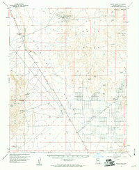
1960 Map of White Hills
USGS Topo · Published 1961About this map
Mining operations dominated the northern edge of the White Hills range during this 1960 field survey, centered on the historic White Hills (Site). The landscape is marked by numerous claims such as the Grand Army of Republic Mine, Bonanza Mine, and the Rip Van Winkle Mine, reflecting the intensive silver and gold extraction efforts of previous decades. A lone Grave sits near these workings, providing a somber connection to the individuals who labored in this arid district.
Find a feature on this map
42 named features on this map. Tap any name to fly to it.
Don’t see what you’re looking for? This feature index may not catch every label — zoom into the map to look around manually.
Map Details
Editions of this 1960 White Hills Map
3 editions found
Other maps of this area

1886 · Camp Mohave
USGS Topo · 1:250,000

1892 · Camp Mohave
USGS Topo · 1:250,000

1926 · Nelson
USGS Topo · 1:96,000

1926 · Mohave City
USGS Topo · 1:96,000

1939 · Chloride
USGS Topo · 1:48,000

1942 · Camp Mohave
USGS Topo · 1:250,000

1944 · Chloride
USGS Topo · 1:62,500

1947 · Kingman
USGS Topo · 1:250,000

1948 · Kingman
USGS Topo · 1:250,000

1954 · Kingman
USGS Topo · 1:250,000