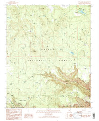
1989 Map of White Horse Lake
USGS Topo · Published 1990About this map
White Horse Lake and the adjacent White Horse Recreation Site serve as central landmarks in this high-elevation landscape within the Kaibab National Forest. The 1989 topography reveals a terrain defined by complex drainage systems and isolated peaks, including White Horse Knoll and Ruin Mountain. A notable concentration of water resources is evident, from natural features like Holloway Spring and Hitt Spring to numerous man-made tanks such as Perkins Tank and JD Dam Lake.
Find a feature on this map
58 named features on this map. Tap any name to fly to it.
Don’t see what you’re looking for? This feature index may not catch every label — zoom into the map to look around manually.
Map Details
Editions of this 1989 White Horse Lake Map
2 editions found
Other maps of this area

1886 · San Francisco Mtns
USGS Topo · 1:250,000

1886 · Chino
USGS Topo · 1:250,000

1887 · Verde
USGS Topo · 1:250,000

1887 · Prescott
USGS Topo · 1:250,000

1891 · San Francisco Mtns
USGS Topo · 1:250,000

1891 · Chino
USGS Topo · 1:250,000

1892 · Verde
USGS Topo · 1:250,000

1892 · Prescott
USGS Topo · 1:250,000

1894 · San Francisco Mtns
USGS Topo · 1:250,000

1899 · San Francisco Mtns
USGS Topo · 1:250,000