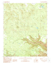
1989 Map of White Horse Lake
USGS Topo · Published 1990About this map
White Horse Lake serves as a focal point in this high-altitude landscape within the Kaibab National Forest, documented just before the 1990s. The terrain is defined by a series of flats and volcanic knolls, including Sunflower Flat and White Horse Knoll, which give way to the dramatic incisions of Sycamore Canyon to the south. This area, partly managed as the Sycamore Canyon Wilderness, shows a complex network of resource management through numerous stock tanks such as Scar Tank, PG Tank, and Saginaw Tank. The presence of JD Dam Lake and the Gravel Pit near Ruin Mountain suggests a landscape utilized for both recreation and local industry. To the southwest, the boundary of the Prescott National Forest meets the rugged pockets of Limestone Pocket and Lonesome Pocket, illustrating the transition into more sequestered canyon topography.
Find a feature on this map
55 named features on this map. Tap any name to fly to it.
Don’t see what you’re looking for? This feature index may not catch every label — zoom into the map to look around manually.
Map Details
Editions of this 1989 White Horse Lake Map
2 editions found
Other maps of this area

1886 · San Francisco Mtns
USGS Topo · 1:250,000

1886 · Chino
USGS Topo · 1:250,000

1887 · Verde
USGS Topo · 1:250,000

1887 · Prescott
USGS Topo · 1:250,000

1891 · San Francisco Mtns
USGS Topo · 1:250,000

1891 · Chino
USGS Topo · 1:250,000

1892 · Verde
USGS Topo · 1:250,000

1892 · Prescott
USGS Topo · 1:250,000

1894 · San Francisco Mtns
USGS Topo · 1:250,000

1899 · San Francisco Mtns
USGS Topo · 1:250,000