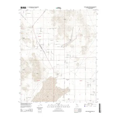
2015 Map of White Horse Mountain
USGS Topo · Published 2015About this map
Lucerne Lake dominates the southern basin of this High Desert landscape, sitting at the junction of several prominent mountain ranges. The terrain transitions from the dry lakebed up toward the Granite Mountains and White Horse Mtn in the west, while the Ord Mountains rise to the northeast. This 2015 U.S. Geological Survey representation shows the growing road network of Lucerne Valley and North Lucerne Valley, where a grid of residential and connector roads like Lucerne Rd and Barstow Rd meet the open expanse of the Mojave Desert. The map provides a clear view of the complex topography of the region, from the steep slopes of Sidewinder Mtn to the isolated peak of Peterman Hill, illustrating how the valley floor is defined by its surrounding high relief.
Find a feature on this map
80 named features on this map. Tap any name to fly to it.
Don’t see what you’re looking for? This feature index may not catch every label — zoom into the map to look around manually.
Map Details
Editions of this 2015 White Horse Mountain Map
This is the sole edition of this map. No revisions or reprints were ever made.
Other maps of this area

1901 · Southern California Sheet No. 1
USGS Topo · 1:250,000

1902 · Deep Creek
USGS Topo · 1:62,500

1902 · San Gorgonio
USGS Topo · 1:125,000

1904 · Southern California Sheet No. 1
USGS Topo · 1:250,000

1932 · Barstow
USGS Topo · 1:125,000

1934 · Barstow
USGS Topo · 1:125,000

1947 · Lucerne Valley
USGS Topo · 1:62,500

1949 · Lucerne Valley
USGS Topo · 1:62,500

1953 · San Bernardino
USGS Topo · 1:250,000

1955 · Ord Mountains
USGS Topo · 1:62,500