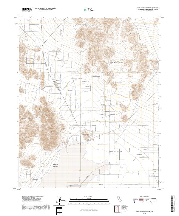
2023 Map of White Horse Mountain
USGS Topo · Published 2023About this map
The high desert landscape of Lucerne Valley and North Lucerne Valley is defined by its transition from residential grids to rugged mountain flanks. To the west, White Horse Mtn and the Granite Mountains rise sharply above the valley floor, while the Ord Mountains dominate the northeastern portion of the quadrangle. This 2023 survey illustrates the modern road network, including the Lucerne Valley Cutoff and Barstow Rd, which connect these desert communities.
Find a feature on this map
80 named features on this map. Tap any name to fly to it.
Don’t see what you’re looking for? This feature index may not catch every label — zoom into the map to look around manually.
Map Details
Editions of this 2023 White Horse Mountain Map
This is the sole edition of this map. No revisions or reprints were ever made.
Other maps of this area

1901 · Southern California Sheet No. 1
USGS Topo · 1:250,000

1902 · Deep Creek
USGS Topo · 1:62,500

1902 · San Gorgonio
USGS Topo · 1:125,000

1904 · Southern California Sheet No. 1
USGS Topo · 1:250,000

1932 · Barstow
USGS Topo · 1:125,000

1934 · Barstow
USGS Topo · 1:125,000

1947 · Lucerne Valley
USGS Topo · 1:62,500

1949 · Lucerne Valley
USGS Topo · 1:62,500

1953 · San Bernardino
USGS Topo · 1:250,000

1955 · Ord Mountains
USGS Topo · 1:62,500