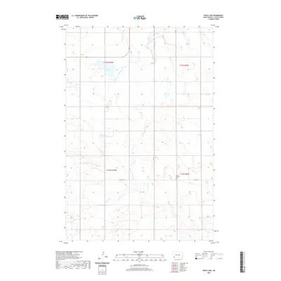
2020 Map of White Lake
USGS Topo · Published 2020About this map
The headwaters of the Cannonball River originate in this section of Slope County, North Dakota, where the prairie landscape is defined by the ephemeral White Lake and the dendritic drainage of N Cedar Cr. The land is organized by the Public Land Survey System, with township and range lines like t135n r100w and t135n r99w carving the plains into a grid that dictates the modern road network. This rural expanse is bisected by Highway 85, which runs north-to-south, providing a primary corridor through the sparsely populated ranchland. Local history is anchored at the Norman Lutheran Cem, a lonely landmark along 69th St SW that stands as a point of continuity for the surrounding agricultural community.
Find a feature on this map
11 named features on this map. Tap any name to fly to it.
Don’t see what you’re looking for? This feature index may not catch every label — zoom into the map to look around manually.
Map Details
Editions of this 2020 White Lake Map
This is the sole edition of this map. No revisions or reprints were ever made.
Other maps of this area

1953 · Dickinson
USGS Topo · 1:250,000

1957 · Dickinson
USGS Topo · 1:250,000

1961 · Daglum
USGS Topo · 1:62,500

1961 · Rocky Ridge
USGS Topo · 1:62,500

1973 · White Lake
USGS Topo · 1:24,000

1973 · Warnke Hill
USGS Topo · 1:24,000

1973 · Mineral Springs
USGS Topo · 1:24,000

1973 · Amidon SE
USGS Topo · 1:24,000

1973 · Amidon
USGS Topo · 1:24,000

1973 · West Rainy Butte
USGS Topo · 1:24,000