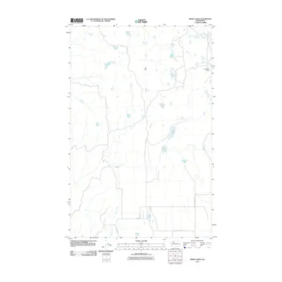
2011 Map of White Lakes
USGS Topo · Published 2011About this map
Timentwa Flats and a scattering of glacial kettle lakes define this portion of Okanogan County as it appeared in the early 21st century. The landscape is characterized by its internal drainage, where water bodies like White Lakes, Lawson Lake, and the small Alkali Pond punctuate a high plateau. A modest network of unpaved roads, including Cameron Lake Rd and Tum Water Basin Rd, provides access across this sparsely populated terrain, where topography rises to landmarks like Salt Hill.
Find a feature on this map
18 named features on this map. Tap any name to fly to it.
Don’t see what you’re looking for? This feature index may not catch every label — zoom into the map to look around manually.
Map Details
Editions of this 2011 White Lakes Map
This is the sole edition of this map. No revisions or reprints were ever made.
Other maps of this area

1905 · Okanogan
USGS Topo · 1:125,000

1950 · Boot Mtn
USGS Topo · 1:62,500

1953 · Omak Lake
USGS Topo · 1:62,500

1954 · Okanogan
USGS Topo · 1:250,000

1957 · Okanogan
USGS Topo · 1:62,500

1957 · Bridgeport
USGS Topo · 1:62,500

1958 · Okanogan
USGS Topo · 1:250,000

1980 · Okanogan
USGS Topo · 1:24,000
1980 · Bridgeport Point
USGS Topo · 1:24,000
1980 · Joe Lake
USGS Topo · 1:24,000