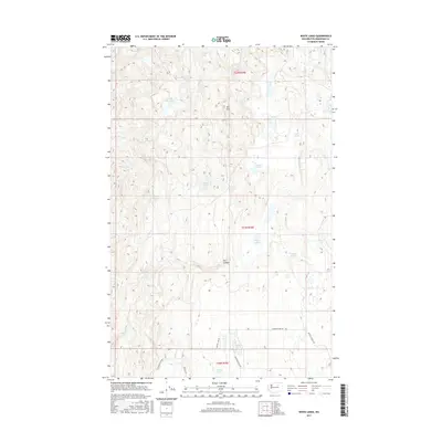
2017 Map of White Lakes
USGS Topo · Published 2017About this map
White Lakes anchors this high-plateau landscape in Okanogan County, where a dense concentration of small water bodies and springs defines the drainage patterns. The terrain is marked by distinct geological features like Salt Hill and the incision of Dan Canyon, illustrating the varied topography of north-central Washington. This 2017 survey reflects a largely undeveloped area characterized by its hydrology, ranging from Deep Lake and Island Lake to the uniquely named Lake Thirty-Two.
Find a feature on this map
23 named features on this map. Tap any name to fly to it.
Don’t see what you’re looking for? This feature index may not catch every label — zoom into the map to look around manually.
Map Details
Editions of this 2017 White Lakes Map
This is the sole edition of this map. No revisions or reprints were ever made.
Other maps of this area

1905 · Okanogan
USGS Topo · 1:125,000

1950 · Boot Mtn
USGS Topo · 1:62,500

1953 · Omak Lake
USGS Topo · 1:62,500

1954 · Okanogan
USGS Topo · 1:250,000

1957 · Okanogan
USGS Topo · 1:62,500

1957 · Bridgeport
USGS Topo · 1:62,500

1958 · Okanogan
USGS Topo · 1:250,000

1980 · Okanogan
USGS Topo · 1:24,000
1980 · Bridgeport Point
USGS Topo · 1:24,000
1980 · Joe Lake
USGS Topo · 1:24,000