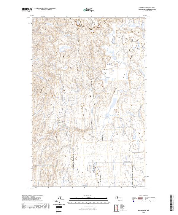
2023 Map of White Lakes
USGS Topo · Published 2023About this map
Salt Hill rises as a prominent landmark in this high-plateau region of Okanogan County, surrounded by a scattered network of small basins and seasonal waters. The landscape is defined by its numerous isolated water bodies, ranging from the central White Lakes and Crowfoot Lake to the uniquely named Lake Thirty-Two and Freshwater Lake in the north. This pattern of drainage suggests a terrain where water accumulates in distinct depressions rather than traditional river systems, though Chicken Creek and Dan Canyon provide more defined relief in the south and west. Local transit is limited to rural routes like Cameron Lake Rd and Paxton Canyon Rd, which navigate the township lines of the t31n r26e and t30n r26e blocks. The presence of Alkali Pond indicates the mineral-heavy character of the local hydrology typical of the basin's geography.
Find a feature on this map
25 named features on this map. Tap any name to fly to it.
Don’t see what you’re looking for? This feature index may not catch every label — zoom into the map to look around manually.
Map Details
Editions of this 2023 White Lakes Map
This is the sole edition of this map. No revisions or reprints were ever made.
Other maps of this area

1905 · Okanogan
USGS Topo · 1:125,000

1950 · Boot Mtn
USGS Topo · 1:62,500

1953 · Omak Lake
USGS Topo · 1:62,500

1954 · Okanogan
USGS Topo · 1:250,000

1957 · Okanogan
USGS Topo · 1:62,500

1957 · Bridgeport
USGS Topo · 1:62,500

1958 · Okanogan
USGS Topo · 1:250,000

1980 · Okanogan
USGS Topo · 1:24,000
1980 · Bridgeport Point
USGS Topo · 1:24,000
1980 · Joe Lake
USGS Topo · 1:24,000