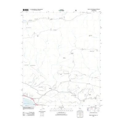
2012 Map of White Ledge Peak
USGS Topo · Published 2012About this map
White Ledge Peak and the surrounding Transverse Ranges dominate this 2012 survey, where steep canyons and high ridges transition toward the Pacific Ocean coastline. The interior is defined by a network of drainage basins, including the Santa Ynez River in the north and Rincon Creek and Coyote Creek flowing south. This topography creates a distinct boundary between the high-altitude wilderness, home to remote sites like the Upper Santa Ynez Camp Ground, and the lower coastal foothills.
Find a feature on this map
56 named features on this map. Tap any name to fly to it.
Don’t see what you’re looking for? This feature index may not catch every label — zoom into the map to look around manually.
Map Details
Editions of this 2012 White Ledge Peak Map
This is the sole edition of this map. No revisions or reprints were ever made.
Other maps of this area

1902 · Santa Ynez
USGS Topo · 1:125,000

1903 · Mt. Pinos
USGS Topo · 1:125,000

1904 · Ventura
USGS Topo · 1:62,500

1905 · Santa Ynez
USGS Topo · 1:125,000

1941 · Ventura
USGS Topo · 1:62,500

1942 · Wheeler Springs
USGS Topo · 1:24,000

1943 · Old Man Mountain
USGS Topo · 1:24,000

1943 · Wheeler Springs
USGS Topo · 1:24,000

1943 · Hildreth Peak
USGS Topo · 1:24,000
1944 · Wheeler Springs
USGS Topo · 1:31,680