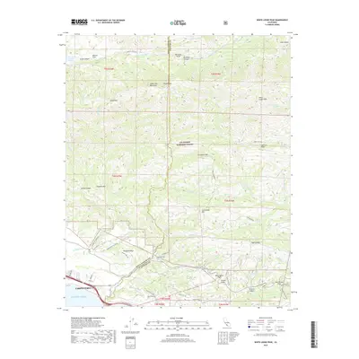
2018 Map of White Ledge Peak
USGS Topo · Published 2018About this map
Carpinteria meets the Pacific Ocean at the southern edge of this survey, where the historic El Camino Real and modern transport corridors hug the coastline. The terrain rises sharply into the Santa Ynez Mountains, where the Los Padres National Forest covers much of the high country. Deep in the interior canyons, water management is evident at Murietta Dam and Jameson Lake, while the Santa Ynez River carves through the northern reaches.
Find a feature on this map
64 named features on this map. Tap any name to fly to it.
Don’t see what you’re looking for? This feature index may not catch every label — zoom into the map to look around manually.
Map Details
Editions of this 2018 White Ledge Peak Map
This is the sole edition of this map. No revisions or reprints were ever made.
Other maps of this area

1902 · Santa Ynez
USGS Topo · 1:125,000

1903 · Mt. Pinos
USGS Topo · 1:125,000

1904 · Ventura
USGS Topo · 1:62,500

1905 · Santa Ynez
USGS Topo · 1:125,000

1941 · Ventura
USGS Topo · 1:62,500

1942 · Wheeler Springs
USGS Topo · 1:24,000

1943 · Old Man Mountain
USGS Topo · 1:24,000

1943 · Wheeler Springs
USGS Topo · 1:24,000

1943 · Hildreth Peak
USGS Topo · 1:24,000
1944 · Wheeler Springs
USGS Topo · 1:31,680