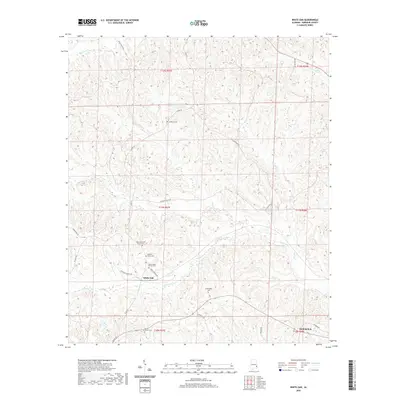
2020 Map of White Oak
USGS Topo · Published 2020About this map
White Oak serves as a central landmark in this portion of Barbour County, where the landscape is defined by the winding course of Barbour Cr and its various tributaries like Leak Cr and Doudy Cr. This 2020 record highlights a dense concentration of family and community burial sites, providing a significant resource for genealogical research in southeastern Alabama. The presence of the Tabernacle AME Church Cem, Beauchamp Family Cem, and Perkins Evans Cem clustered near the White Oak settlement suggests a long-standing rural community structure tied to the local land. To the north, Claytons Pond and Academy Cem sit near the junction of Co RD 79, while the southeastern corner touches the outskirts of Eufaula. The drainage patterns of Chewalla Cr and Bronson Cr illustrate the undulating terrain that dictates the winding paths of local roads such as Old Batesville Rd.
Find a feature on this map
34 named features on this map. Tap any name to fly to it.
Don’t see what you’re looking for? This feature index may not catch every label — zoom into the map to look around manually.
Map Details
Editions of this 2020 White Oak Map
This is the sole edition of this map. No revisions or reprints were ever made.
Other maps of this area

1953 · Dothan
USGS Topo · 1:250,000

1954 · Dothan
USGS Topo · 1:250,000

1955 · Dothan
USGS Topo · 1:250,000

1955 · Phenix City
USGS Topo · 1:250,000

1957 · Phenix City
USGS Topo · 1:250,000

1958 · Phenix City
USGS Topo · 1:250,000

1967 · Clayton South
USGS Topo · 1:24,000

1968 · Eufaula North
USGS Topo · 1:24,000

1968 · Baker Hill
USGS Topo · 1:24,000

1968 · White Oak
USGS Topo · 1:24,000