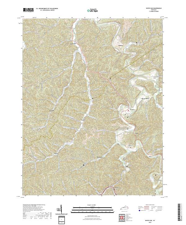
2022 Map of White Oak
USGS Topo · Published 2022About this map
Magoffin and Morgan Counties meet along a ridge-and-valley landscape defined by the serpentine Licking River. This 2022 survey captures the settlement patterns of eastern Kentucky, where small communities like White Oak, Harper, and Wonnie are connected by a network of rural roads following the natural contours of the land. The mapping of cemeteries provides significant genealogical value, noting several family-specific sites such as the Andrew Jackson Patton Cem, Patrick and Lovely Cem, and Saul Howard Cem. Navigation throughout this area centers on river features like Carpenter Bend and Fanning Bend, while prominent landforms such as Jeff Lewis Hill and Ditney Ridge dominate the horizon. The presence of Pipeline Rd and multiple unnamed structures suggests a mix of residential and industrial footprints within the Appalachian foothills.
Find a feature on this map
128 named features on this map. Tap any name to fly to it.
Don’t see what you’re looking for? This feature index may not catch every label — zoom into the map to look around manually.
Map Details
Editions of this 2022 White Oak Map
This is the sole edition of this map. No revisions or reprints were ever made.
Other maps of this area

1889 · Salyersville
USGS Topo · 1:125,000

1891 · Salyersville
USGS Topo · 1:125,000

1899 · Salyersville
USGS Topo · 1:125,000

1950 · Lenox
USGS Topo · 1:24,000

1951 · Cannel City
USGS Topo · 1:24,000

1951 · White Oak
USGS Topo · 1:24,000
1951 · Dingus
USGS Topo · 1:24,000
1951 · Salyersville North
USGS Topo · 1:24,000
1951 · Lenox
USGS Topo · 1:24,000

1951 · Seitz
USGS Topo · 1:24,000