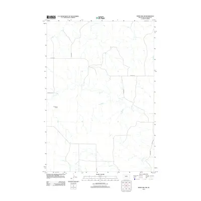
2012 Map of White Owl NW
USGS Topo · Published 2012About this map
Cherry Cr and Elm Cr weave through the open rangeland of Meade County, defining a landscape of sprawling ranching operations in this part of South Dakota. The drainage patterns of White Owl Cr in the southeast corner illustrate the subtle topography of the high plains. Human presence is sparse, centered around large family holdings like the Cobb Ranch Airstrip, which serves as a vital transportation point for remote agricultural operations. A network of rural roads, including Red Owl Rd, Fox Ridge Rd, and Pleasant View Rd, follows the section lines, providing the primary framework for navigation across this isolated prairie terrain. The map captures the enduring character of the northern plains, where the grid of county highways such as Co Hwy Mc-26 meets the meandering natural paths of the local creeks.
Find a feature on this map
12 named features on this map. Tap any name to fly to it.
Don’t see what you’re looking for? This feature index may not catch every label — zoom into the map to look around manually.
Map Details
Editions of this 2012 White Owl NW Map
This is the sole edition of this map. No revisions or reprints were ever made.
Other maps of this area

1953 · Rapid City
USGS Topo · 1:250,000

1957 · Rapid City
USGS Topo · 1:250,000

1959 · Enning
USGS Topo · 1:24,000

1959 · Redowl
USGS Topo · 1:24,000

1983 · Whiteman Owl NW
USGS Topo · 1:24,000

1983 · Opal West SE
USGS Topo · 1:24,000

1983 · Whiteman Owl
USGS Topo · 1:24,000
1983 · Whiteman Owl SE
USGS Topo · 1:24,000

1983 · Opal East SW
USGS Topo · 1:24,000

1983 · Marcus
USGS Topo · 1:24,000