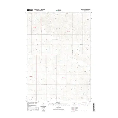
2015 Map of White Owl NW
USGS Topo · Published 2015About this map
Red Owl Cr and White Owl Cr carve through this section of Meade County, defining a landscape of drainage basins and high plains ridges. The road network reflects a structured ranching or agricultural pattern, with routes like Fox Ridge Rd, Red Owl Rd, and Sulphur Dr following the high ground or section lines between the creek valleys. Local thoroughfares such as Green Valley Rd and Spring Creek Rd provide access to the various townships, including t9n r13e and t8n r14e. The topography is further marked by Elm Cr in the north, while smaller access ways like Tidewater Pl and Lang Rd hint at more localized property divisions or homestead access points.
Find a feature on this map
16 named features on this map. Tap any name to fly to it.
Don’t see what you’re looking for? This feature index may not catch every label — zoom into the map to look around manually.
Map Details
Editions of this 2015 White Owl NW Map
This is the sole edition of this map. No revisions or reprints were ever made.
Other maps of this area

1953 · Rapid City
USGS Topo · 1:250,000

1957 · Rapid City
USGS Topo · 1:250,000

1959 · Enning
USGS Topo · 1:24,000

1959 · Redowl
USGS Topo · 1:24,000

1983 · Whiteman Owl NW
USGS Topo · 1:24,000

1983 · Opal West SE
USGS Topo · 1:24,000

1983 · Whiteman Owl
USGS Topo · 1:24,000
1983 · Whiteman Owl SE
USGS Topo · 1:24,000

1983 · Opal East SW
USGS Topo · 1:24,000

1983 · Marcus
USGS Topo · 1:24,000