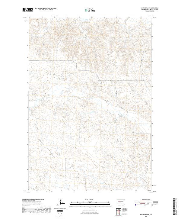
2021 Map of White Owl NW
USGS Topo · Published 2021About this map
Red Owl Creek and Elm Cr flow through this section of Meade County, shaping a landscape defined by seasonal drainages and high plains ranching infrastructure. The map documents a sparsely populated region of South Dakota where the Public Land Survey System grid remains the primary organizing force, evidenced by the prominent township and range boundaries of t9n r14e and t8n r14e. Long stretches of county roads and local tracks, such as Co Hwy Mc-26 and Spring Creek Rd, connect isolated homesteads and grazing lands. The network of waterways including Spring Cr and Red Owl Cr highlights the vital importance of drainage patterns in this semi-arid environment, providing essential context for land use and historical property boundaries in the early twenty-first century.
Find a feature on this map
15 named features on this map. Tap any name to fly to it.
Don’t see what you’re looking for? This feature index may not catch every label — zoom into the map to look around manually.
Map Details
Editions of this 2021 White Owl NW Map
This is the sole edition of this map. No revisions or reprints were ever made.
Other maps of this area

1953 · Rapid City
USGS Topo · 1:250,000

1957 · Rapid City
USGS Topo · 1:250,000

1959 · Enning
USGS Topo · 1:24,000

1959 · Redowl
USGS Topo · 1:24,000

1983 · Whiteman Owl NW
USGS Topo · 1:24,000

1983 · Opal West SE
USGS Topo · 1:24,000

1983 · Whiteman Owl
USGS Topo · 1:24,000
1983 · Whiteman Owl SE
USGS Topo · 1:24,000

1983 · Opal East SW
USGS Topo · 1:24,000

1983 · Marcus
USGS Topo · 1:24,000