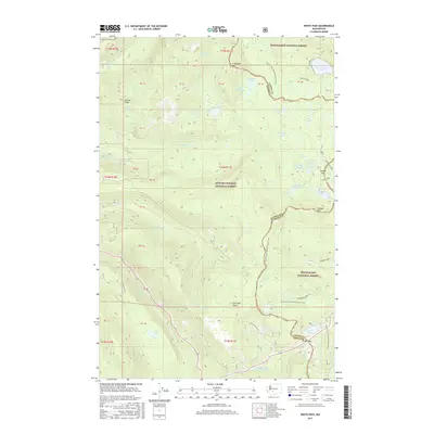
2017 Map of White Pass
USGS Topo · Published 2017About this map
White Pass serves as a critical alpine crossing on the divide between the Gifford Pinchot National Forest and the Snoqualmie National Forest. This high-altitude landscape is defined by its complex network of water bodies, including Leech Lake, Dumbbell Lake, and Sand Lake, which feed the headwaters of the Clear Fork Cowlitz River. The topography is marked by significant peaks such as Cramer Mtn and Fryingpan Mtn, with the Pacific Crest National Scenic Trail winding through the eastern half of the quadrangle. Researchers can trace the drainage patterns from Cowlitz Pass and observe the glacial-cut features of Carlton Ridge and Cortright Point. The map provides a look at the modern forest management boundaries between Yakima and Lewis counties, documenting the high Cascades just before the turn of the decade.
Find a feature on this map
47 named features on this map. Tap any name to fly to it.
Don’t see what you’re looking for? This feature index may not catch every label — zoom into the map to look around manually.
Map Details
Editions of this 2017 White Pass Map
This is the sole edition of this map. No revisions or reprints were ever made.
Other maps of this area

1902 · Mount Aix
USGS Topo · 1:125,000

1904 · Mt Aix
USGS Topo · 1:125,000

1924 · Mt Rainier
USGS Topo · 1:96,000

1928 · Mt Rainier
USGS Topo · 1:125,000

1950 · Yakima
USGS Topo · 1:250,000

1958 · Yakima
USGS Topo · 1:250,000

1961 · Yakima
USGS Topo · 1:250,000

1962 · Bumping Lake
USGS Topo · 1:62,500

1962 · White Pass
USGS Topo · 1:62,500

1962 · Packwood
USGS Topo · 1:62,500