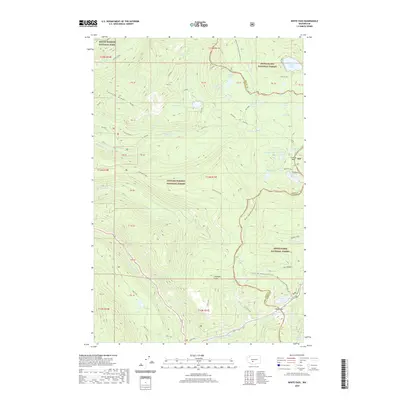
2020 Map of White Pass
USGS Topo · Published 2020About this map
White Pass Highway provides the primary access through this high-altitude landscape where the borders of Mount Rainier National Park, Gifford Pinchot National Forest, and Snoqualmie National Forest converge. The Pacific Crest National Scenic Trail winds north-to-south along the crest, passing notable mountain gaps like White Pass and Cowlitz Pass. This modern survey details the hydrological network of the Cascades, including the headwaters of the Bumping River and numerous alpine basins such as Twin Sisters Lakes, Leech Lake, and Sand Lake. The map illustrates the complex administrative geography of Lewis and Yakima counties, showing how the rugged terrain of Carlton Ridge and Tumac shaped historical travel corridors and modern conservation boundaries.
Find a feature on this map
75 named features on this map. Tap any name to fly to it.
Don’t see what you’re looking for? This feature index may not catch every label — zoom into the map to look around manually.
Map Details
Editions of this 2020 White Pass Map
This is the sole edition of this map. No revisions or reprints were ever made.
Other maps of this area

1902 · Mount Aix
USGS Topo · 1:125,000

1904 · Mt Aix
USGS Topo · 1:125,000

1924 · Mt Rainier
USGS Topo · 1:96,000

1928 · Mt Rainier
USGS Topo · 1:125,000

1950 · Yakima
USGS Topo · 1:250,000

1958 · Yakima
USGS Topo · 1:250,000

1961 · Yakima
USGS Topo · 1:250,000

1962 · Bumping Lake
USGS Topo · 1:62,500

1962 · White Pass
USGS Topo · 1:62,500

1962 · Packwood
USGS Topo · 1:62,500