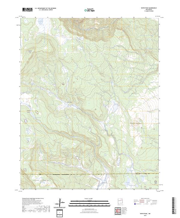
2023 Map of White Peak
USGS Topo · Published 2023About this map
White Peak and the high mesa country of Northern New Mexico define this landscape at the boundary of Colfax and Mora Counties. This modern survey illustrates a complex high-elevation watershed where headwaters like Rayado Creek and Banderitas Creek originate near the Crater Peak summit. The presence of numerous named alpine water bodies, including Sawmill Lake, Caldwell Lake, and Salt Lake, indicates the seasonal hydrology of the Laguna Salada Mesa region. Named landmarks such as White Vega and Ortega Mesa suggest a history of high-country grazing and transit, while remote access points like Whites Peak Rd and Abreau Rd provide the only modern corridors through this steep topography. The map detail effectively captures the transition from peak-fed streams to the flat-topped mesas that characterize this portion of the Sangre de Cristo foothills.
Find a feature on this map
37 named features on this map. Tap any name to fly to it.
Don’t see what you’re looking for? This feature index may not catch every label — zoom into the map to look around manually.
Map Details
Editions of this 2023 White Peak Map
This is the sole edition of this map. No revisions or reprints were ever made.
Other maps of this area

1954 · Raton
USGS Topo · 1:250,000

1956 · Tooth Of Time
USGS Topo · 1:62,500

1956 · Miami
USGS Topo · 1:62,500

1958 · Raton
USGS Topo · 1:250,000

1966 · Guadalupita
USGS Topo · 1:24,000

1966 · Mora Ranch
USGS Topo · 1:24,000

1966 · Ocate
USGS Topo · 1:24,000

1981 · Springer
USGS Topo · 1:100,000

1983 · Taos
USGS Topo · 1:100,000
1987 · Agua Fria Peak
USGS Topo · 1:24,000