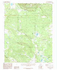
1987 Map of White Peak
USGS Topo · Published 1987About this map
Philmont Scout Ranch dominates the northeastern landscape of this high-altitude territory, where the Beaubien and Miranda Boundary marks historical land grant divisions. The terrain is characterized by significant volcanic and mesa features, most notably the towering White Peak and its associated White Peak Lookout Tower, overlooking the expansive Ortega Mesa. The settlement pattern reflects the area's ranching heritage, with seasonal outposts such as La Grulla Cow Camp and Martinez Cow Camp situated near vital water sources like La Grulla Lake and Rayado Creek.
Find a feature on this map
46 named features on this map. Tap any name to fly to it.
Don’t see what you’re looking for? This feature index may not catch every label — zoom into the map to look around manually.
Map Details
Editions of this 1987 White Peak Map
This is the sole edition of this map. No revisions or reprints were ever made.
Other maps of this area

1954 · Raton
USGS Topo · 1:250,000

1956 · Tooth Of Time
USGS Topo · 1:62,500

1956 · Miami
USGS Topo · 1:62,500

1958 · Raton
USGS Topo · 1:250,000

1966 · Guadalupita
USGS Topo · 1:24,000

1966 · Mora Ranch
USGS Topo · 1:24,000

1966 · Ocate
USGS Topo · 1:24,000

1981 · Springer
USGS Topo · 1:100,000

1983 · Taos
USGS Topo · 1:100,000
1987 · Agua Fria Peak
USGS Topo · 1:24,000